An all-season hike due to the favourable exposure of the route on the adret and the very moderate altitude. The path on the left bank of the valley offers multiple panoramas of the restanques* boldly suspended above the Roya.
* restanque : cultivation land
DESCRIPTION :
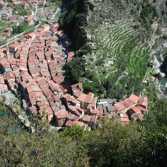
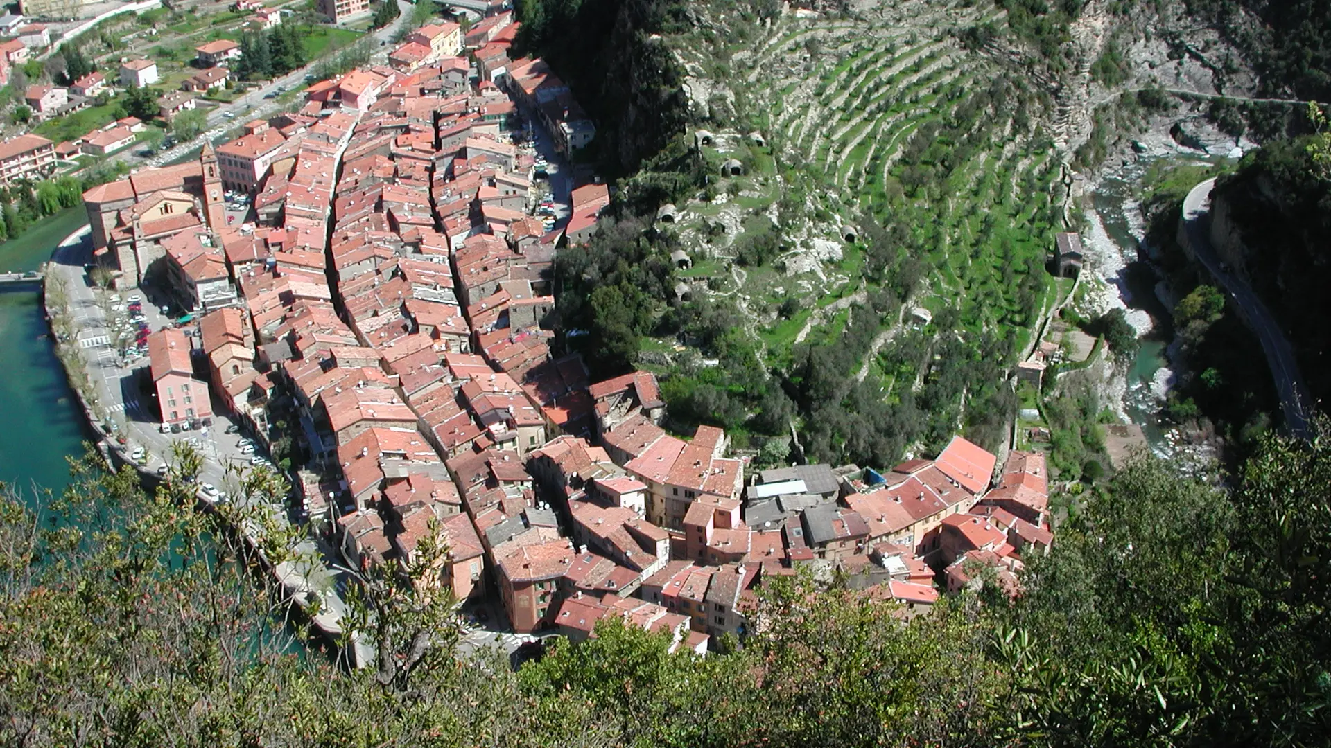
From the oldest part south of the village of Breil-sur-Roya (b.3), nestled in the shelter of a rocky outcrop, dominated by the "Castel" destroyed in the 17th century, follow the course of the Roya for about 300 m through the Genoa gate and the Saint-Antoine chapel (b.105).
Follow the mule track to the old stone bridge in the Carleva valley (b.104).
Go up the Praghiou farm track (b.106), near the "Saveur caprine" farm.
Climb a rocky bar (480 m) to the hamlet of Bourgogni (b.416).
Cross the gentle plateau of Libre and then descend through pine and olive trees (b.413, 412).
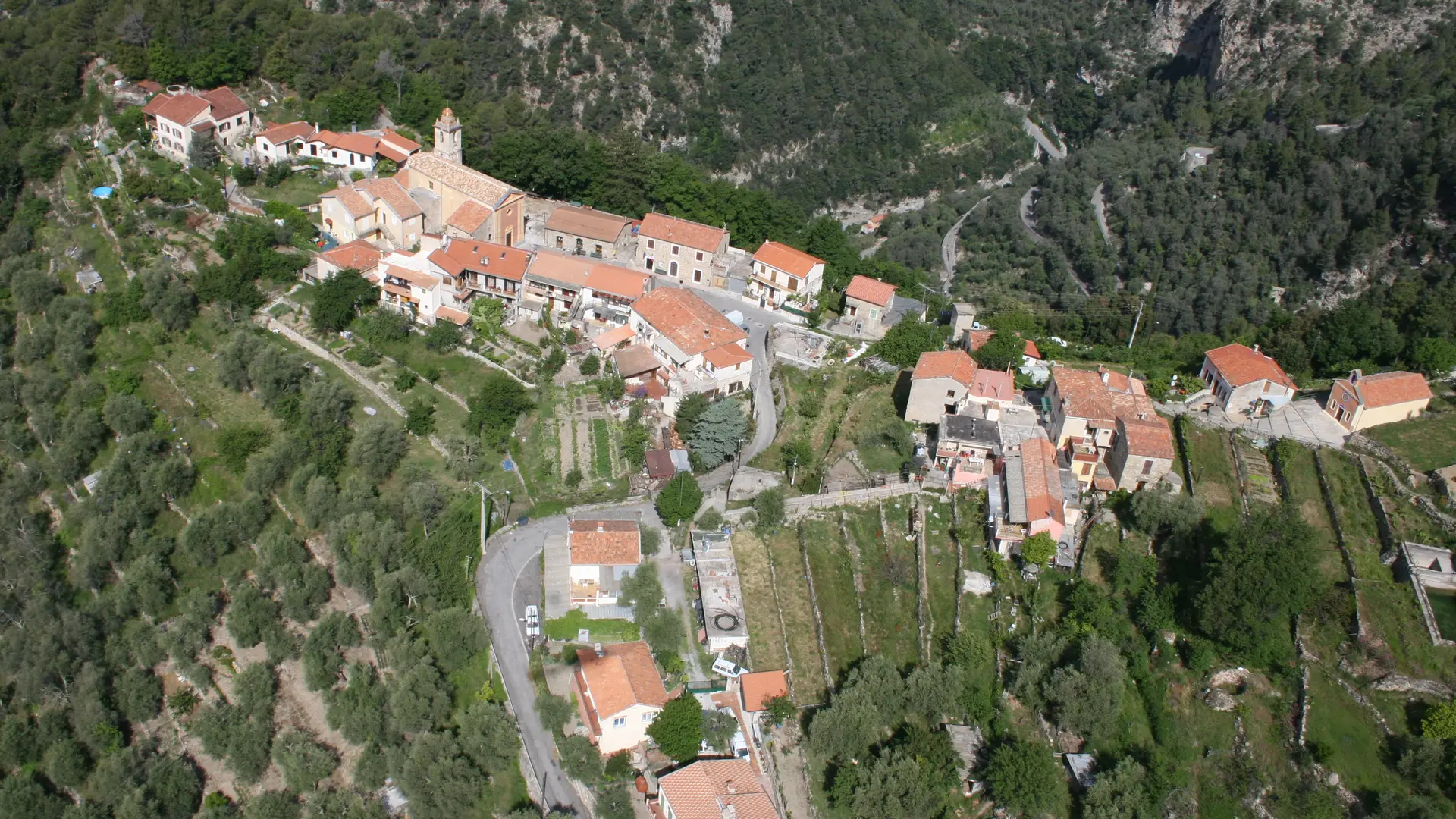
From the ruined hamlet of Cabo (336 m), you can see the hamlets of Piène-Haute and Libre.
Descend on a ledge through the pine forest dotted with small "casouns". Just before marker 411, cross the Audin stream on an old restored bridge. Go back, still among the olive trees, in the direction of the border marker.
After a steady climb through the olive groves, you come to the Italian hamlet of Fanghetto; the path then descends and comes close to the river.
Under stone arches, you cross the high houses of the hamlet before descending to a charming white chapel.
Follow the orographic left bank of the Roya to the Airole square (150 m).
Services
Free car park
Car park
Openings
All year 2026 - Open everyday


