Ideal for families and young children, this grassy Alpine path cut into the rock face on the Val Castérino begins in the high mountains (2050m).
The adventure begins after the Peyrafique drop (beacon 371), where access is possible by 4x4 or with a vehicle with sufficient ground clearance.
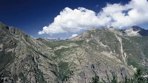
The route opens onto a charming larch wood before reaching the Barchenzane mountain pasture. Here you can enjoy a wonderful view of the Val Castérino, a picturesque tableau of meadows and houses scattered on either side of the torrential valley.
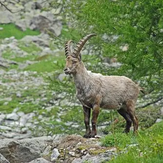
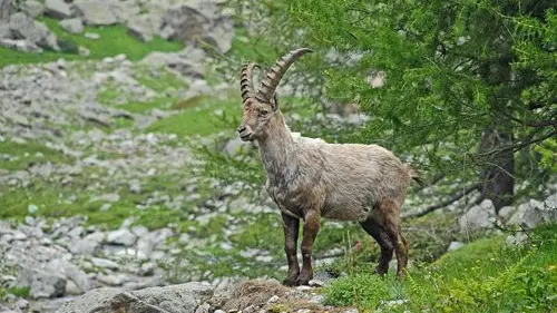
Following the signs for the "Col du Sabion" at marker 372, the route leads to vaulted, grass-covered dwellings at 2236m altitude, witnesses to the military past of the 19th century. The route then crosses the Sabion mountain pasture to reach the Col du Sabion, which marks the border between the Mercantour and Alpi Marittime Natural Parks. From here, you can see the small Lago della Vacca on the Italian side, gradually conquered by alluvial deposits. Keep your eyes peeled: chamois and ibex are often within sight.
The return journey takes the same route, allowing you to relive the magnificent scenery and perhaps catch a glimpse of details missed on the outward journey.
Difficulté = Easy
Rates
Free access.
—
Openings
All year 2026 - Open everyday
Location
Environment
Environment
- Mountain view
- Panoramic view
- Forest location
- Mountain location
- In a nature reserve
- Presence of livestock and guard dogs
Access
Access
- Access by car to the Baisse de Peïrefique is via a rough road, narrow in places. It's best to take a slightly higher vehicle or a 4X4.
After passing through the hamlet of Casterino, the initially tarmac track becomes dirt and leads to the Potamou barrier, one of the "gateways" to the national park.
Turn right onto the track towards Baisse de Peyrefique. After 5km from Potamou, park your vehicle in the parking lot next to marker 371 and follow the signs for "Col du Sabion".
Parking: Baisse de Peïrefique.
