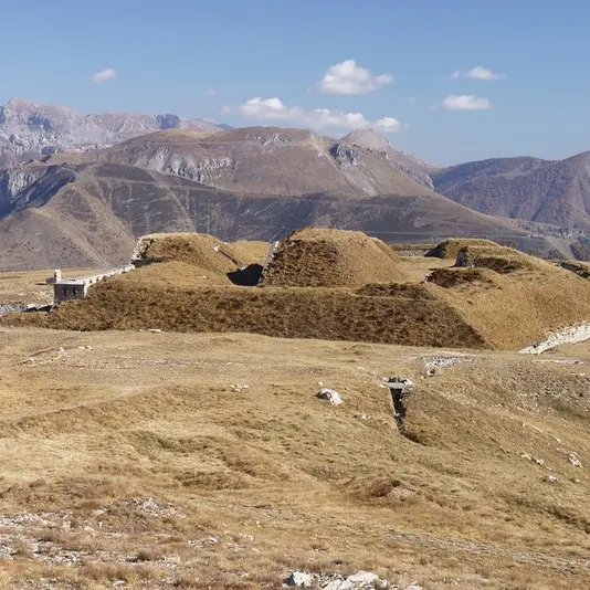
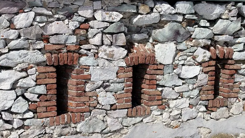
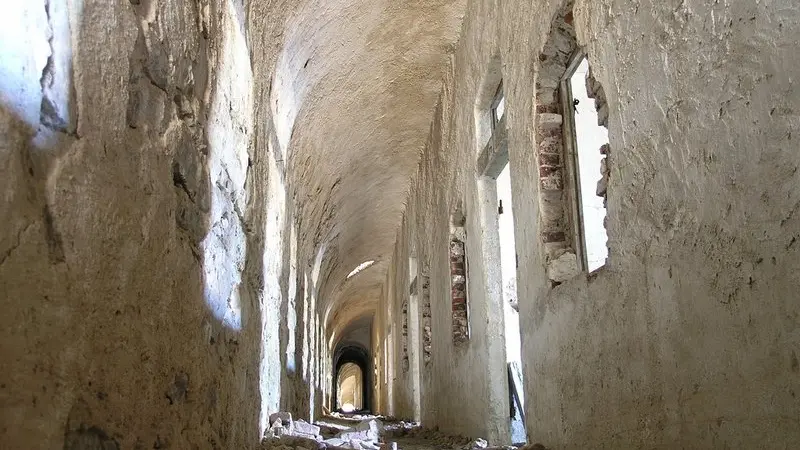
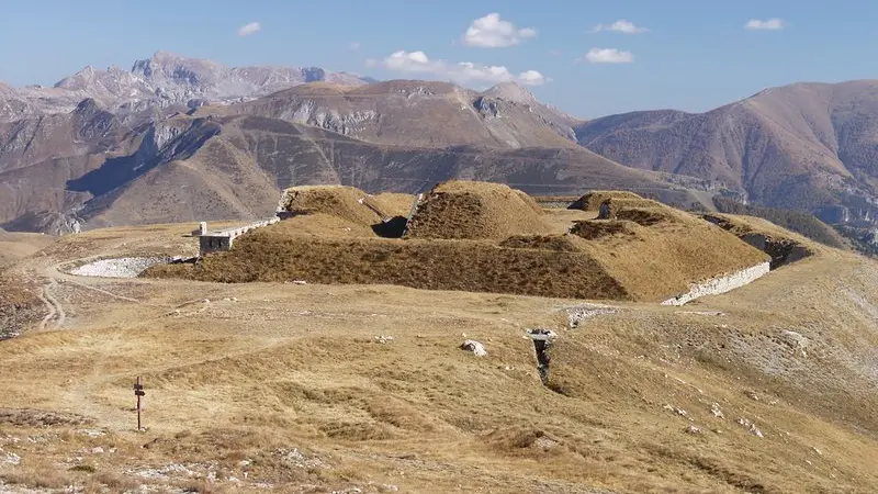
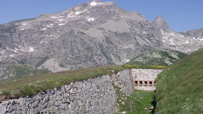
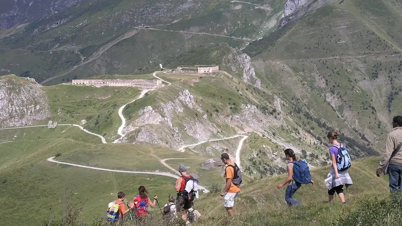
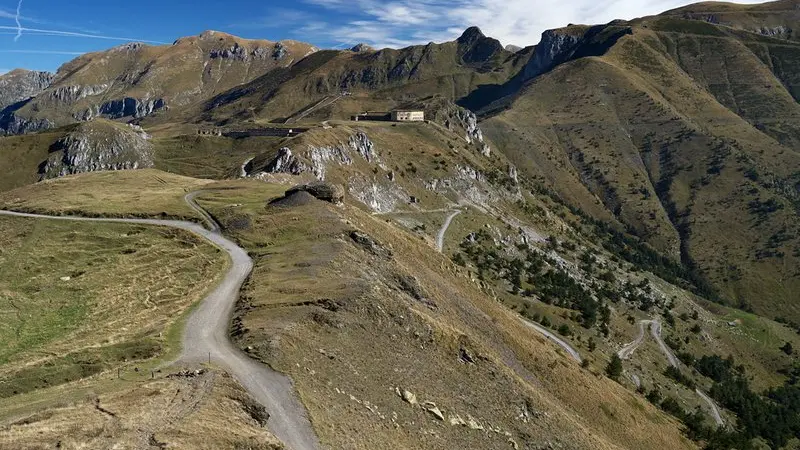
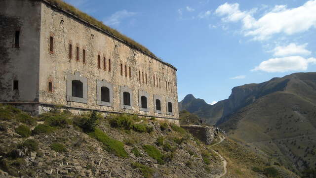
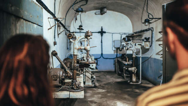
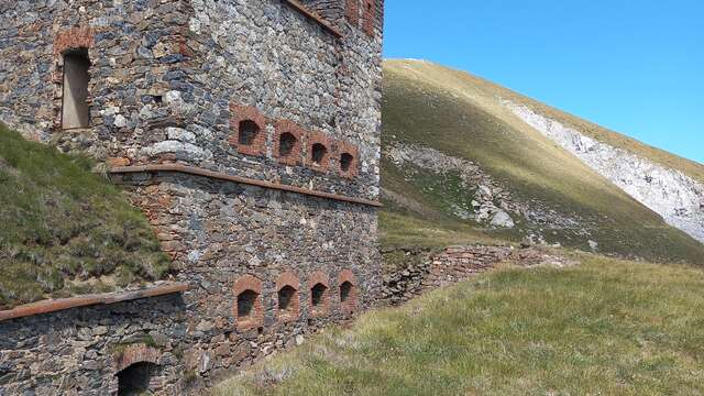
----------------------From Colle di Tenda (1871 m), the route follows the dirt road for Casterino (to the right, coming from Limone), climbing up as far as the hamlet of Colletta, where there is a crossroad with a former military service road, blocked by a crossbar, which leads to Fort Pernante and Fort Giaura. Between the two roads, the route continues on a clearly visible trail that climbs steeply up the slope along the broad divide, among pastures and copses of alders. The trail, extremely panoramic, proceeds less steeply until it rejoins the former military service road leading to the fort, which it had brushed up against twice before. Followng this to the left, after a single switchback the road soon comes to Fort Pernante (formerly Forte Pernante, 2114 m, 45 minutes from Colle di Tenda). On the western slope below the fort, the trail descends through a patch of alders almost to the old road, turning away from it immediately to round the knoll of Cime de Salaute on the left, which the road instead passes to the right (north) side, which is far less exposed to enemy gunfire. The trail traverses flatly mid slope before rejoining the road, now the size of a mule track, near another small pass beyond the Cime de Salaute.The route follows the mule track to the left and shortly comes to another small pass, the Bassa sovrana di Margheria (2079 m, 35 minutes from Fort Pernante), where, at a signpost marking the border, it is joined from the right by a trail from the Gias Prati della Chiesa and Limonetto.At the foot of the craggy slope of the Cima di Giaura, the trail passes by a path on the left that climbs up very steeply to the crest of the ridge, staying instead on the mule track that veers eastward and traverses, slightly uphill, on a rocky base. At the first switchback, to the left, the route leaves the old road (which, due to several landslides further uphill, is no longer passable even on foot) and follows the trail to the right, across a scree. The trail leads along the edge of a detritic hollow, through bushes, and passes just uphill of a miniscule lake without a name. After a long traverse, the trail crosses a small stream and reaches the eastern shore of Lake dell'Abisso (2207 m, 25 minutes from the Bassa sovrana di Margheria). The trail then inverts its direction, proceeding uphill to the southeast until it rejoins the military road it came from, at the last switchback below the fort. With a challenging traverse along rocky cliff walls (attention to the brief tracts over landslides, quite exposed), the trail finally arrives at the grassy flat area on which stands the Fort de Giaure (formerly Forte Giaura, 2254 m, 15 minutes from Lake dell'Abisso).
Difficulté = Medium
Read more