
The name Le Broc comes from Broccos, spur, point.
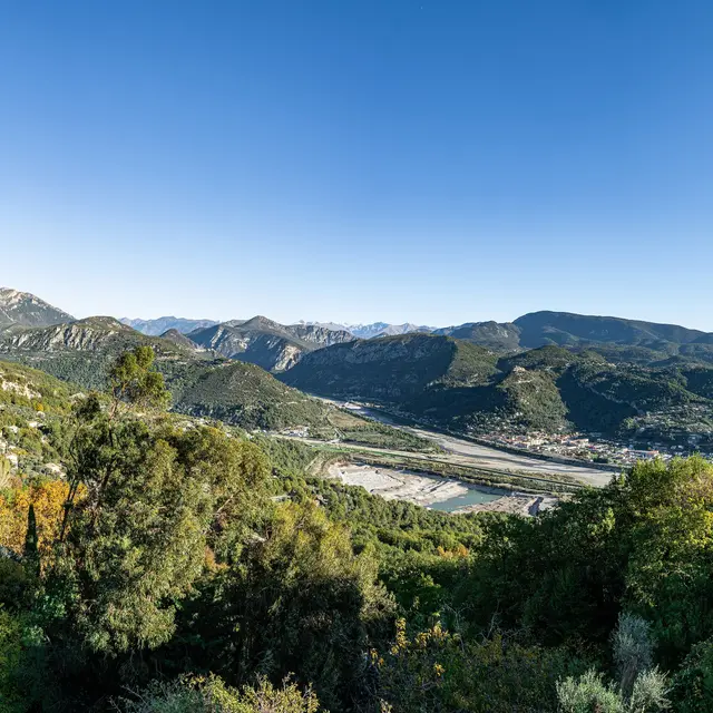
From here, a majestic panorama opens up between the Var and Estéron rivers, overlooking the northern part of the lower Var valley, which opens onto more mountainous landscapes.
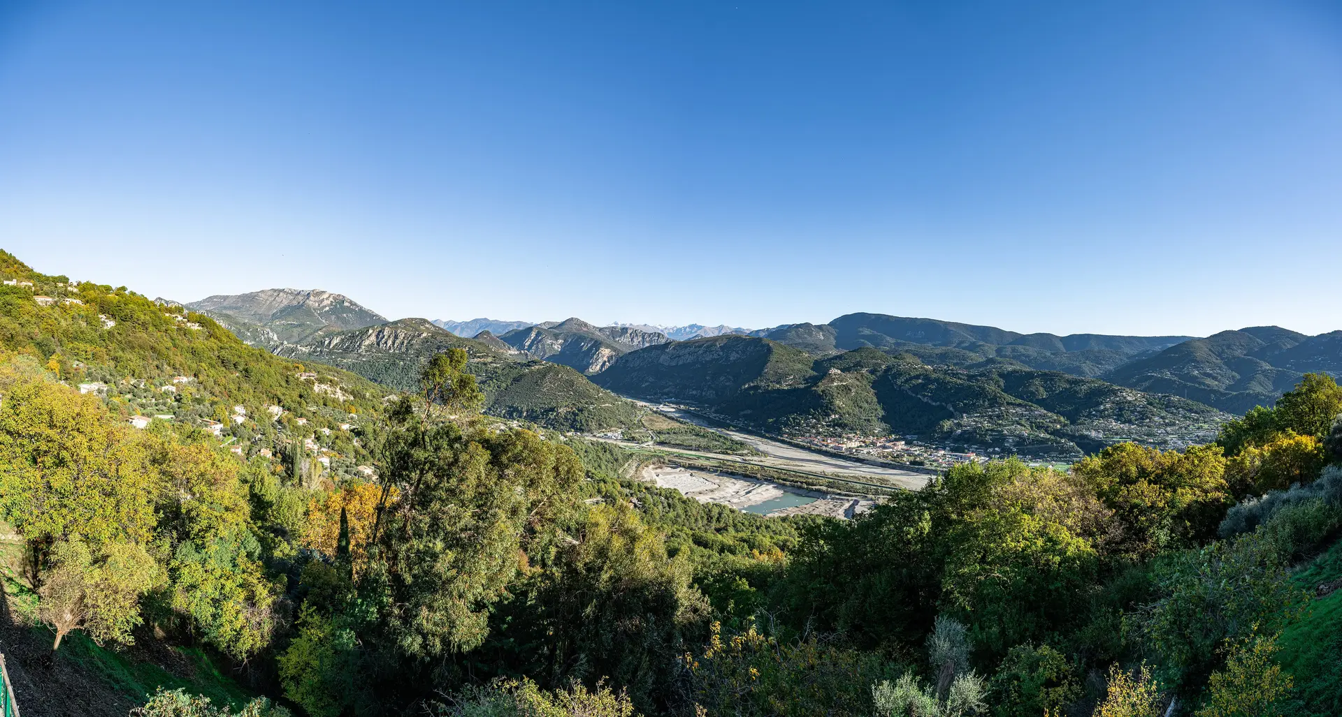
From here, a majestic panorama opens up between the Var and Estéron rivers, overlooking the northern part of the lower Var valley, which opens onto more mountainous landscapes.
Landscape interpretation :
As you glide down the forest-covered slope, your eyes first come to rest on the right bank of the Var, on Lac du Broc, a body of water created by the extraction of aggregates by ballastiers in the mid-1950s, 90% of which is fed by the Var's alluvial aquifer. Water levels can vary by up to 11 metres between high and low water periods.
The dike between the river and the lake leads to a bridge over the Estéron, a tributary of the Var. The road continues, leaving on its right a vast expanse, the Bec de l'Estéron, a protected biotope area for protected plant species. The road then joins the Pont Charles Albert, which allows you to cross the river and find, on the left bank, the agricultural plain of La Roquette sur Var and its hamlet of Baus Roux. Further south, the commune of Saint-Martin du Var.
As you climb the hillsides, you can see the hilltop villages of Gilette, Bonson and La Roquette sur Var from west to east, and the grey patches of olive orchards scattered around the villages.
Rates
Free access.
—
Location
Spoken languages
Spoken languages
Environment
Environment
- Overview on river
- Mountain view
- Panoramic view
- Lake view
