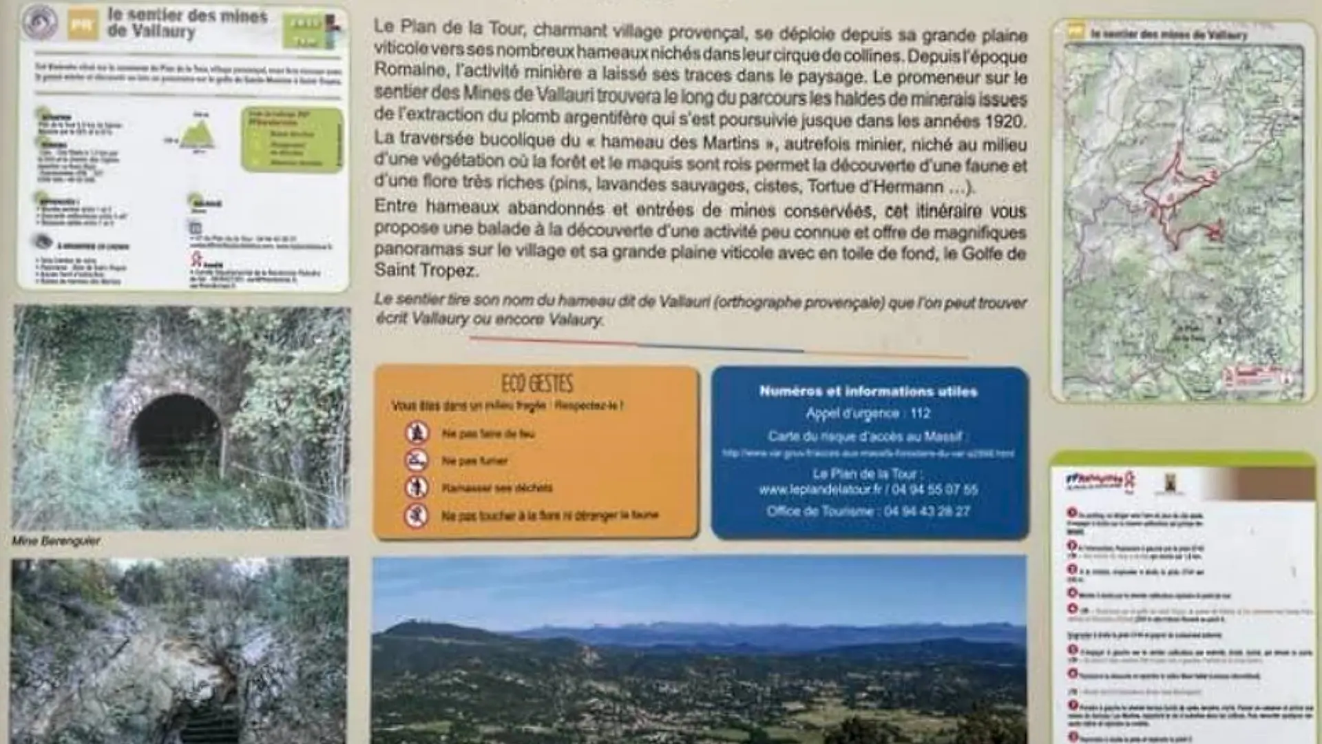
This itinerary, located in the commune of Plan de la Tour, a Provençal village, will take you back to the mining past and give you a panoramic view of the gulf from Sainte Maxime to Saint Tropez.
Read moreShow less
UTM coordinates: 32T 0300 948 / 48 02 6081
Start 1.6 km from downtown Le Plan de la Tour. Take the D44, then at the La Buon Aigo housing estate, follow the Chemin des Cigales towards the city stadium playground.
From the parking lot, turn right onto the gravel path, which climbs steeply.
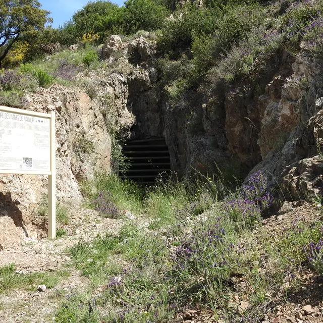
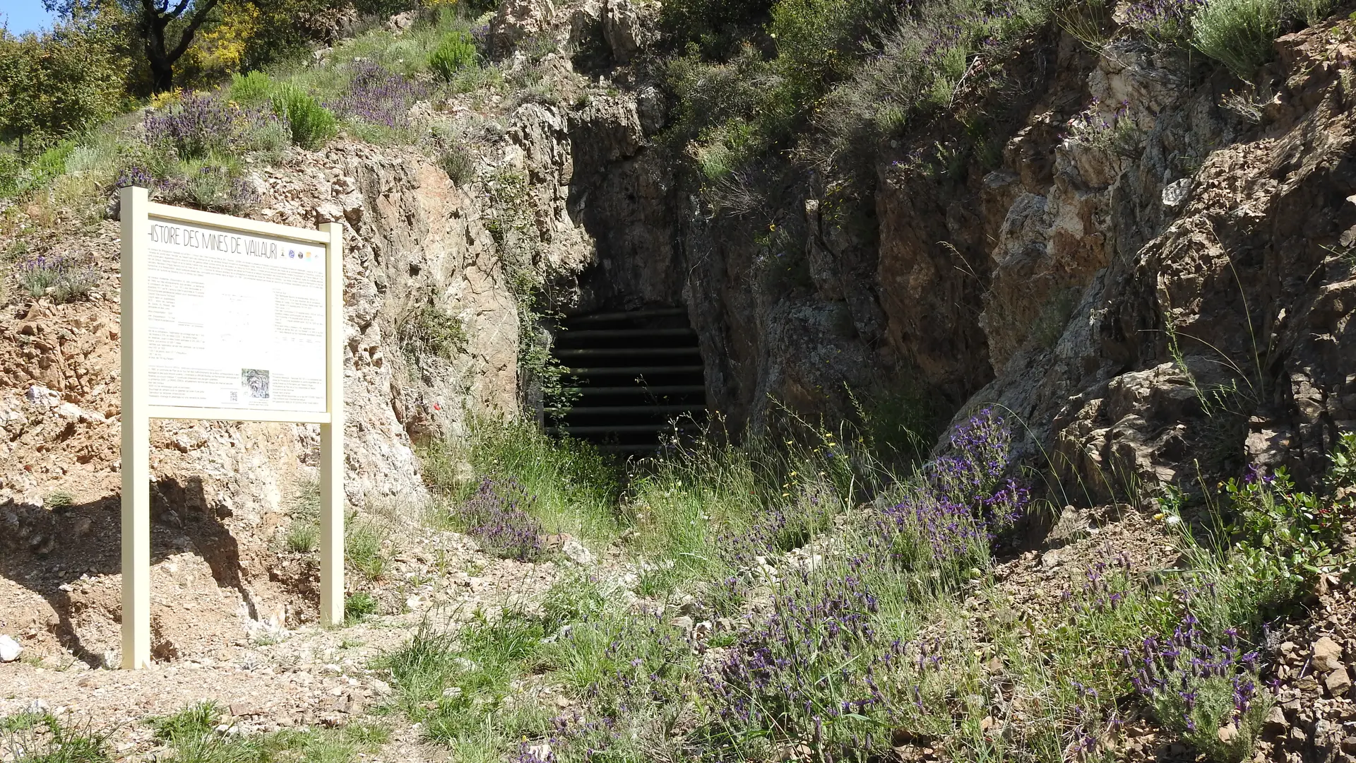
At the intersection, turn left onto the E743 track [ A mine entrance on the right] which climbs for 1.6 km.
At the crossroads, turn right onto track E744 for 230 m.
Go right up the gravel path to the...
Start 1.6 km from downtown Le Plan de la Tour. Take the D44, then at the La Buon Aigo housing estate, follow the Chemin des Cigales towards the city stadium playground.
From the parking lot, turn right onto the gravel path, which climbs steeply.
At the intersection, turn left onto the E743 track [ A mine entrance on the right] which climbs for 1.6 km.
At the crossroads, turn right onto track E744 for 230 m.
Go right up the gravel path to the...
Services
Services
Car park
Pets welcome
Openings
Openings
All year 2025 - Open everyday
