A very beautiful and long circuit: you go up by the small road on the right bank of the northern slope of the Maglia, then by the laces of the Bois Noir track to the limits of the Mercantour park. Once you have passed the Agnon pass, you go back down to the south side.
From the Place Biancheri in front of the tourist office, cross the Lac aux Cygnes on the Charabot bridge. Go straight up under the small railway tunnel.
After the tunnel, go up to the right.
You will pass the Saint-Antoine de Padoue chapel on your left.
You can take the road to Ciaus on your left, or continue to take the next road, the small road to Madonna du Mont.
Take a break at the beautiful chapel surrounded by olive trees. Continue to climb until you reach the RD 2204.
Turn left, and you will take the small road of La Maglia very quickly on your right.
You will never leave it. Stop from time to time to contemplate the gorges that it overlooks.
You will pass a small tunnel, as well as the hiking sign on your left for the Morghé valley n°100.
Continue on.
Pass the car park and the marker n°145 which indicates on the right the descent to the Maglia canyon.
At marker 101, you leave the goudront to take the wide Bois Noir trail on your left.
At marker 103 you leave the Conffrey track on your right and continue to climb on the same track.
You reach the limits of the Mercantour National Park, marker 140.
The track continues eastwards, following the boundaries of the Park.
At marker 135 on your left, a path joins the Agnon pass (1074 m), which the trail skirts.
You then begin the long descent southwards via Campé.
The views of the Haute-Roya mountains, Saorge and Breil below are breathtaking and plunging: don't hesitate to stop!
You will pass a sheepfold, and shortly afterwards a DFCI tank on your left.
You continue to wind down the "chemin du col d'Agnon" in the "Bourgemo district", where you come across some beautiful olive groves.
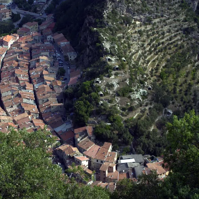
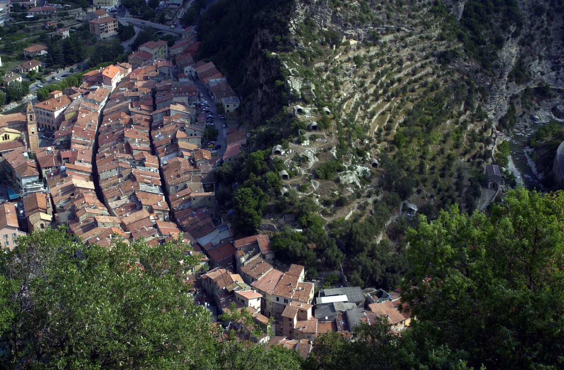
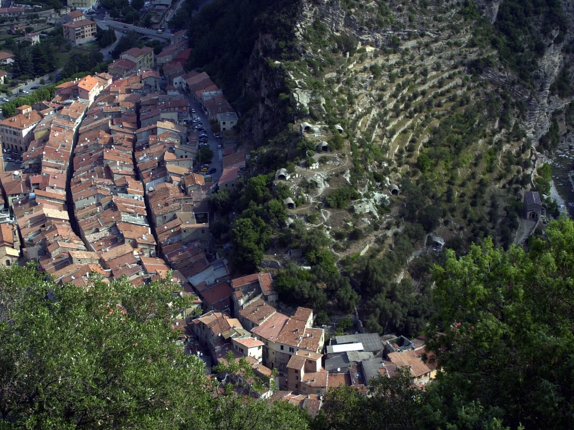
Turn LEFT onto the Bourgemo path to pass through the "Granile district", which allows you to avoid the road and still enjoy magnificent views of the village of Saorge.
After a few twists and turns, you will reach the beginning of the small road of La Maglia, and you can reach your starting point more quickly by descending directly by the small road of Burdanche which descends steeply to the right at the beginning of the road of Notre-Dame-du-Mont.
After the tunnel, go up to the right.
You will pass the Saint-Antoine de Padoue chapel on your left.
You can take the road to Ciaus on your left, or continue to take the next road, the small road to Madonna du Mont.
Take a break at the beautiful chapel surrounded by olive trees. Continue to climb until you reach the RD 2204.
Turn left, and you will take the small road of La Maglia very quickly on your right.
You will never leave it. Stop from time to time to contemplate the gorges that it overlooks.
You will pass a small tunnel, as well as the hiking sign on your left for the Morghé valley n°100.
Continue on.
Pass the car park and the marker n°145 which indicates on the right the descent to the Maglia canyon.
At marker 101, you leave the goudront to take the wide Bois Noir trail on your left.
At marker 103 you leave the Conffrey track on your right and continue to climb on the same track.
You reach the limits of the Mercantour National Park, marker 140.
The track continues eastwards, following the boundaries of the Park.
At marker 135 on your left, a path joins the Agnon pass (1074 m), which the trail skirts.
You then begin the long descent southwards via Campé.
The views of the Haute-Roya mountains, Saorge and Breil below are breathtaking and plunging: don't hesitate to stop!
You will pass a sheepfold, and shortly afterwards a DFCI tank on your left.
You continue to wind down the "chemin du col d'Agnon" in the "Bourgemo district", where you come across some beautiful olive groves.
Turn LEFT onto the Bourgemo path to pass through the "Granile district", which allows you to avoid the road and still enjoy magnificent views of the village of Saorge.
After a few twists and turns, you will reach the beginning of the small road of La Maglia, and you can reach your starting point more quickly by descending directly by the small road of Burdanche which descends steeply to the right at the beginning of the road of Notre-Dame-du-Mont.
Openings
All year 2026 - Open everyday
Location
Contact Mountain bike tour (AE) from the Maglia valley to Borgemo via the Agnon Pass
Spoken languages
Spoken languages
