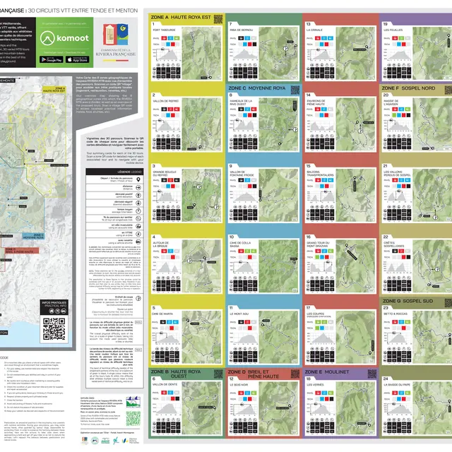
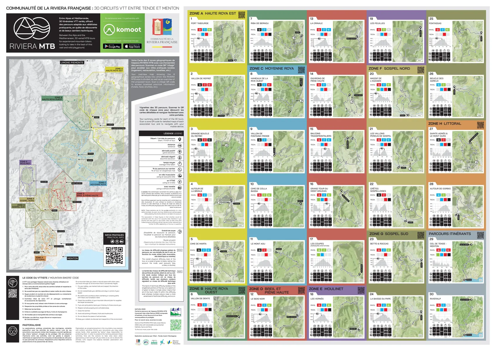
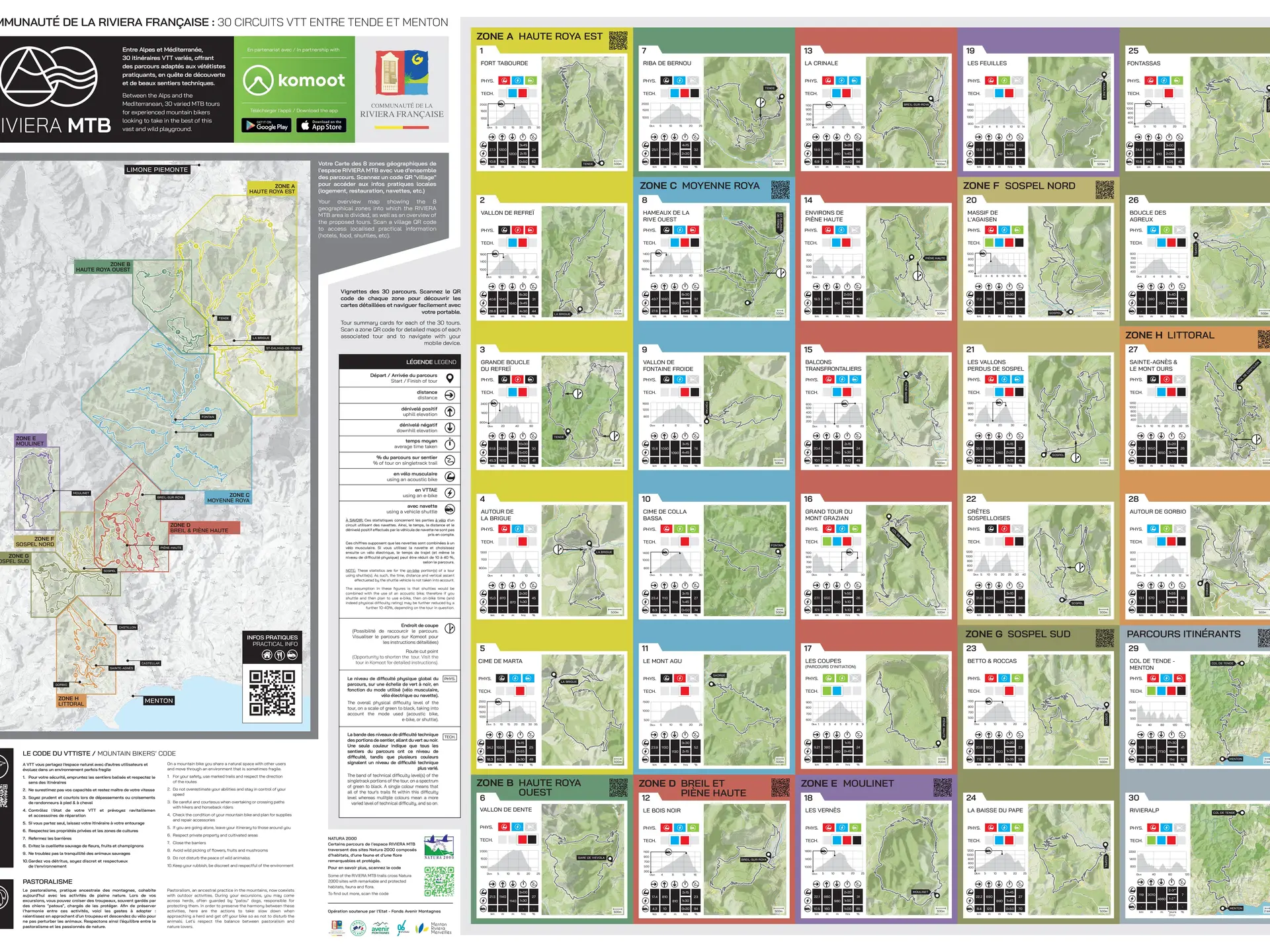
Set off on an adventure to the foothills of the Marguareis! From Tende or La Brigue, climb via Morignole and the Ugail drop to the spectacular Castel Tournou. Enjoy the panoramic views before descending through the Refreï valley.
Leave La Brigue for the hamlet of Morignole on the road of the same name. Pass the Pont du Coq, the lime kiln and the old mill, then follow the signs for Morignole. Continue along the road, climbing through the hamlet, past the parking lot, then continue along the road, which soon becomes a dirt, gravel and pebble track.
Head for Baisse de l'Ugail, tackling a steep climb of several kilometers. Once at the top of the drop (marker 300), you'll enjoy a magnificent panorama of the surrounding mountains. Continue on the trail to Vallon de Mérigiane, then turn east towards Baisse de la Crouseta. It is also possible to stay on the main trail and shorten the itinerary by passing through the Rochers de Servia.
At the top of the Baisse de la Crouseta (marker 312), continue due north along the signposted route. At marker 314, turn south along the Refraï torrent to reach Castel Tournou (marker 317). Continuing south, at marker 1317, the more adventurous can take the path up to the Vallon de Lamantargue. Alternatively, you can follow the torrent towards Tende.
At marker 321, head due south to Grange de Pont-Pauvre, then up the track to marker 1032, before descending along the Cagnourine track towards the GR52A. You finally reach Tende.
To return to La Brigue, take the path over the Col de Lubaira to complete the itinerary.
Services
Pets welcome
Rates
Free access.
—
Openings
All year 2026 - Open everyday
Subject to favorable weather
Subject to snow conditions
Location
Spoken languages
Spoken languages
Environment
Environment
- Mountain view
- Panoramic view
- Forest location
- Mountain location
- Isolated
- Presence of livestock and guard dogs
