An adventure par excellence, the Bendola in its entirety remains the wildest canyon in the Alpes-Maritimes: its exceptionally extensive route combines remoteness, difficulty and commitment like no other.
This interminable descent takes place over two days, with a bivouac halfway down the route, and covers a distance of 15 km and a vertical drop of 1,400 m, making it one of the longest canyons in Europe. Carrying a lot of equipment, due to the bivouac and the height of the waterfalls, slows progress, but you must be completely self-sufficient, because if there is an accident in the first part of the route, there is a risk of a delay in transmitting the alarm.
Level of difficulty: Rating 5.3.VI
Vertical: Difficult
Aquatic character: Not very difficult
Involvement and wingspan: VI
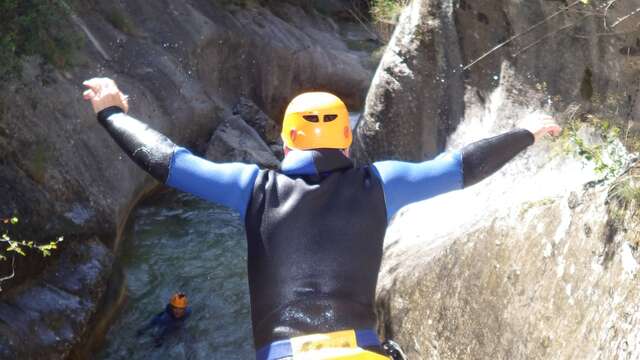
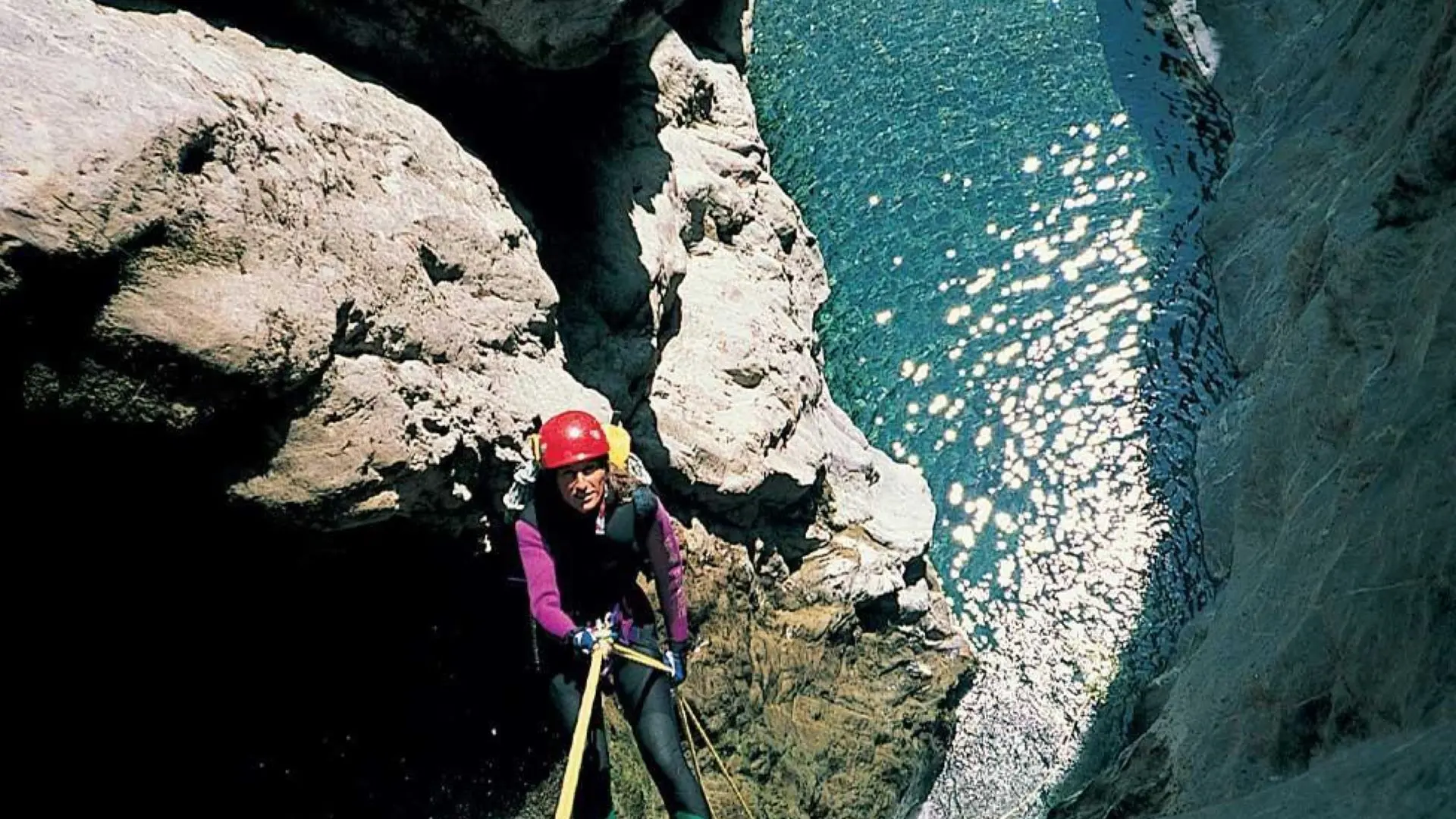
Useful equipment: Personal equipment, group equipment, bivouac equipment, 2 x 50m ropes, 1 x 30m rope, +1 emergency rope.
Type of rock: Limestone
Water flow (low water): 60 l/s
Water temperature: 16° to 17° C
Catchment area: 28 km2
Vertical drop : - 1400 m
Canyon length: 15 km
Maximum waterfall: 50 m
Flood risk: 4/5
ITINERARY
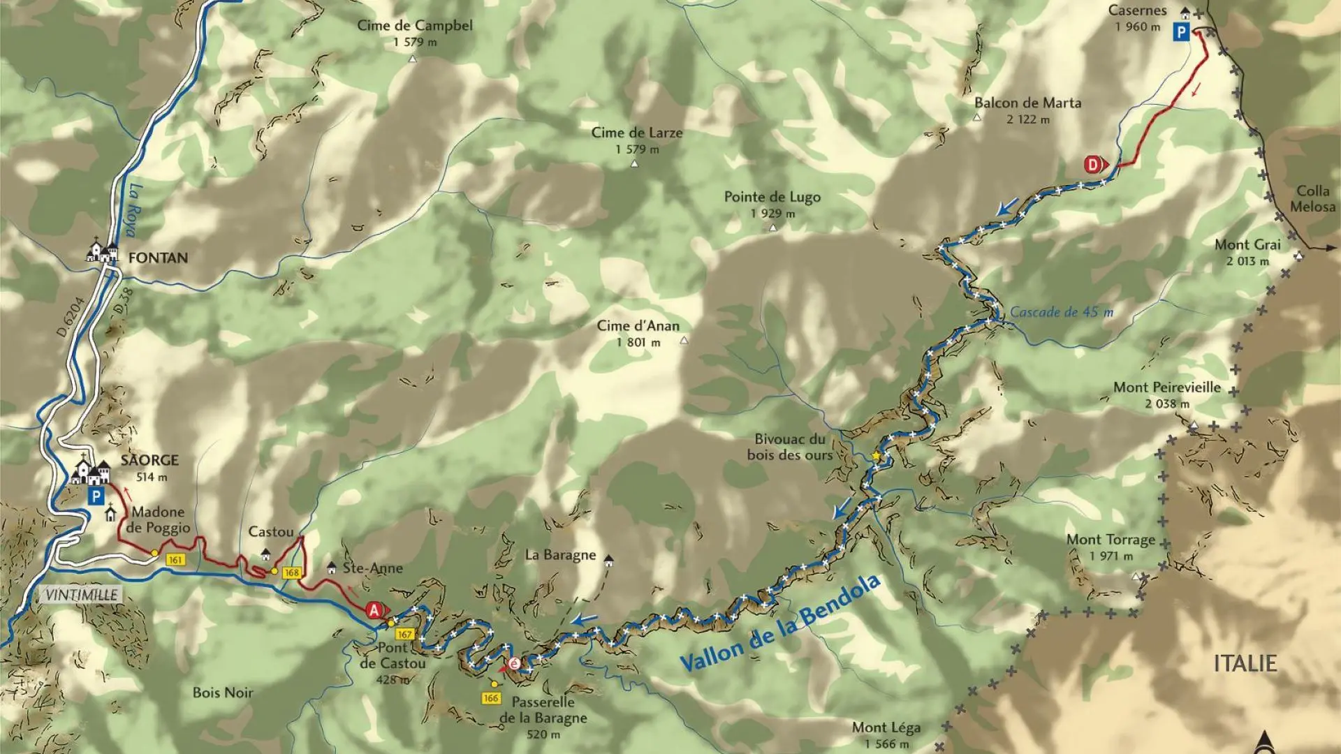
Shuttle bus: 30 kilometres
Follow the RD 6204 as far as St-Dalmas-de-Tende; turn right onto the route de la Brigue, go through the village and continue as far as the Notre-Dame-des-Fontaines chapel. Continue down the valley and turn right onto a forest track which climbs a long slope to reach the Sanson drop (4 x 4 vehicle recommended). Turn right to follow the track southwards on the Italian side; it leads to the ruined barracks below the summit of Marta. Leave your vehicle there.
Access on foot: 0 hour 30 minutes
From the barracks (1,960 m), descend directly through the mountain pastures to reach the valley, which is generally dry, and follow it to the first obstacles (1,800 m).
Descent of the canyon: 2 days
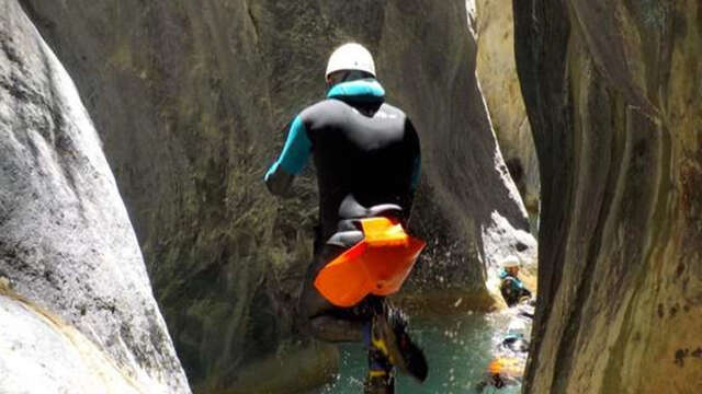
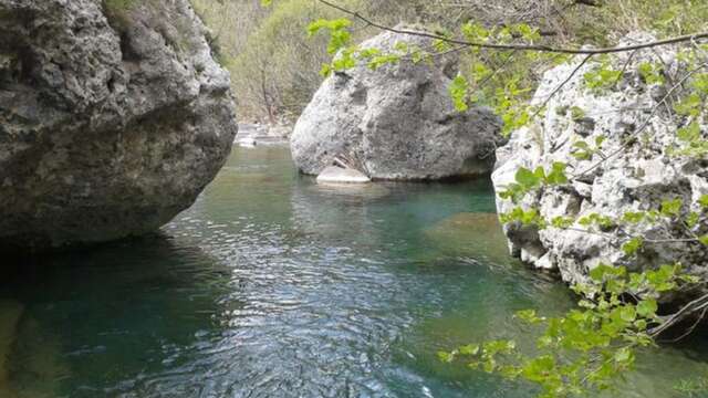
First follow the valley, which is usually dry upstream. A dozen or so abseils, between walking areas, follow each other down to a more incised section where the water appears (a long, somewhat monotonous section). A few jumps then lead to the first major waterfall, which consists of a 20 m slope over a 45 m drop: take care when manoeuvring as the belay at the top of this waterfall is very narrow.
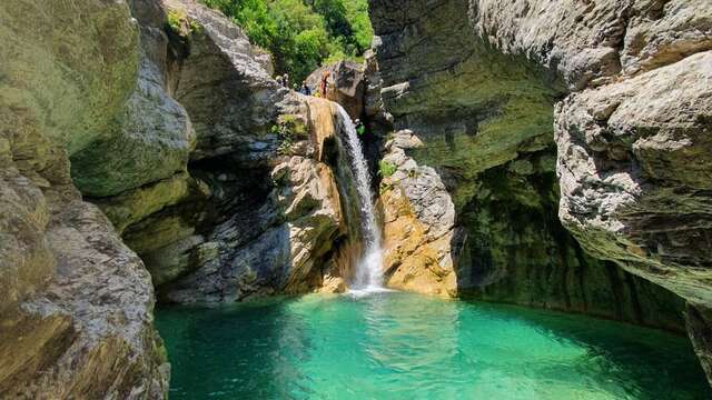
Other waterfalls then follow uninterrupted until you reach the bivouac: in total, you will have to make around thirty abseils in waterfalls of less than 25 m, with the exception of a splendid 40 m vertical drop into a pool (surely the most beautiful part of the descent).
Pass a first bivouac site on the left bank of the river to find a more comfortable spot shortly afterwards: when you reach a ledge overlooking a beautiful heart-shaped basin, climb up the right bank on a good track to reach a large forest flat, a favourite bivouac spot called the ‘Bois des Ours’, located on the last bend of the Bendola before the Graon valley.
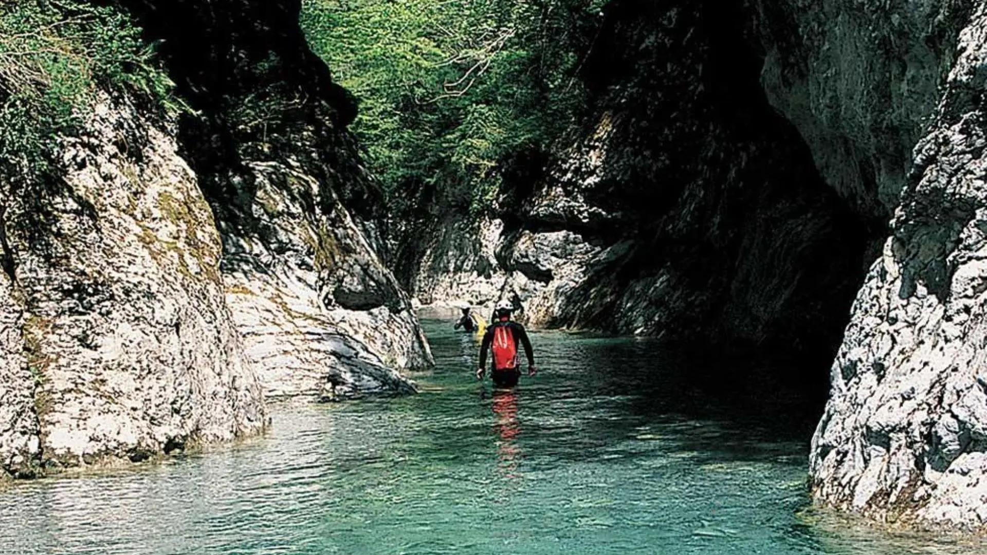
On the second day, the use of the rope is no longer essential and, after a few jumps, it's a very long and somewhat tedious river walk that you have to do to reach the Baragne footbridge, 5 km further on (you can escape via a path on the left bank).
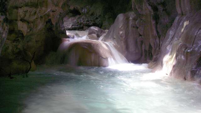
The descent then becomes very steep and watery, with a succession of very long, almost uninterrupted swims until you reach a beautiful arched bridge at the end of the canyon (Pont de Castou). Please note that the end of the descent of the Bendola between the Castou bridge and the RD 6204 is forbidden. Please note! Severe flooding can trap tree trunks and branches at the start of the waterfalls.
As a result, progress is hampered and sealed spindles become unusable (natural moorings possible). In addition, snow slides can block the top of the valley at the start of the season, making progress tricky or even dangerous.
Return on foot: 1 hour 30 minutes
From the Castou bridge (428 m), take the track along the right bank of the valley to reach the ruins of the Castou barns (b.168). From the track, take the old Saorge road (b.161) up to the Madonna de Poggio and through the pretty little streets lined with tall houses, cross Saorge to the car park if you came via the village of Fontan.
Location
Contact Randoxygène ‘Clues et Canyons’ guide: the Bendola in its entirety
Spoken languages
Spoken languages
Environment
Environment
- Mountain location
Access
Access
- You need 2 vehicles to make the 30 km shuttle. The easiest way is to park one in the village of Saorge, on the Fontan access side.
With the other, follow the RD 6204 as far as St-Dalmas-de-Tende; turn right onto the route de la Brigue, go through the village and continue as far as the Notre-Dame-des-Fontaines chapel. Continue down the valley and turn right onto a forest track which climbs a long slope to reach the Sanson drop (4 x 4 vehicle recommended). Turn right to follow the track southwards on the Italian side, which leads to the ruined barracks below the summit of Marta, where you can park your vehicle.