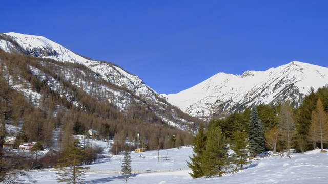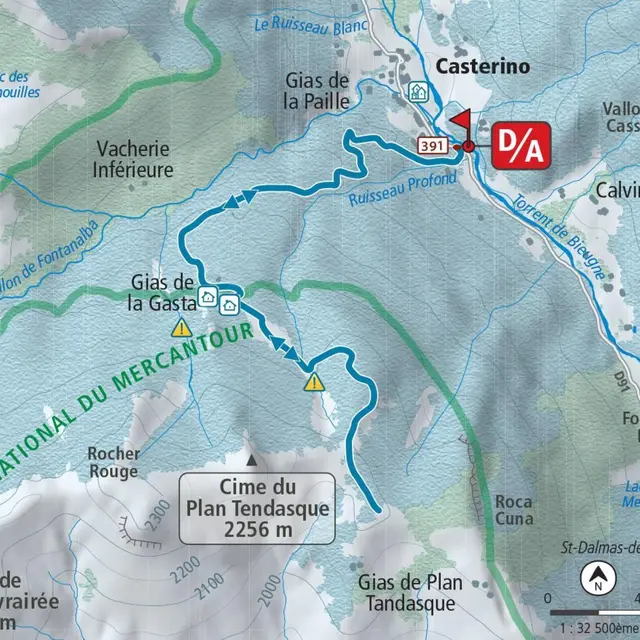
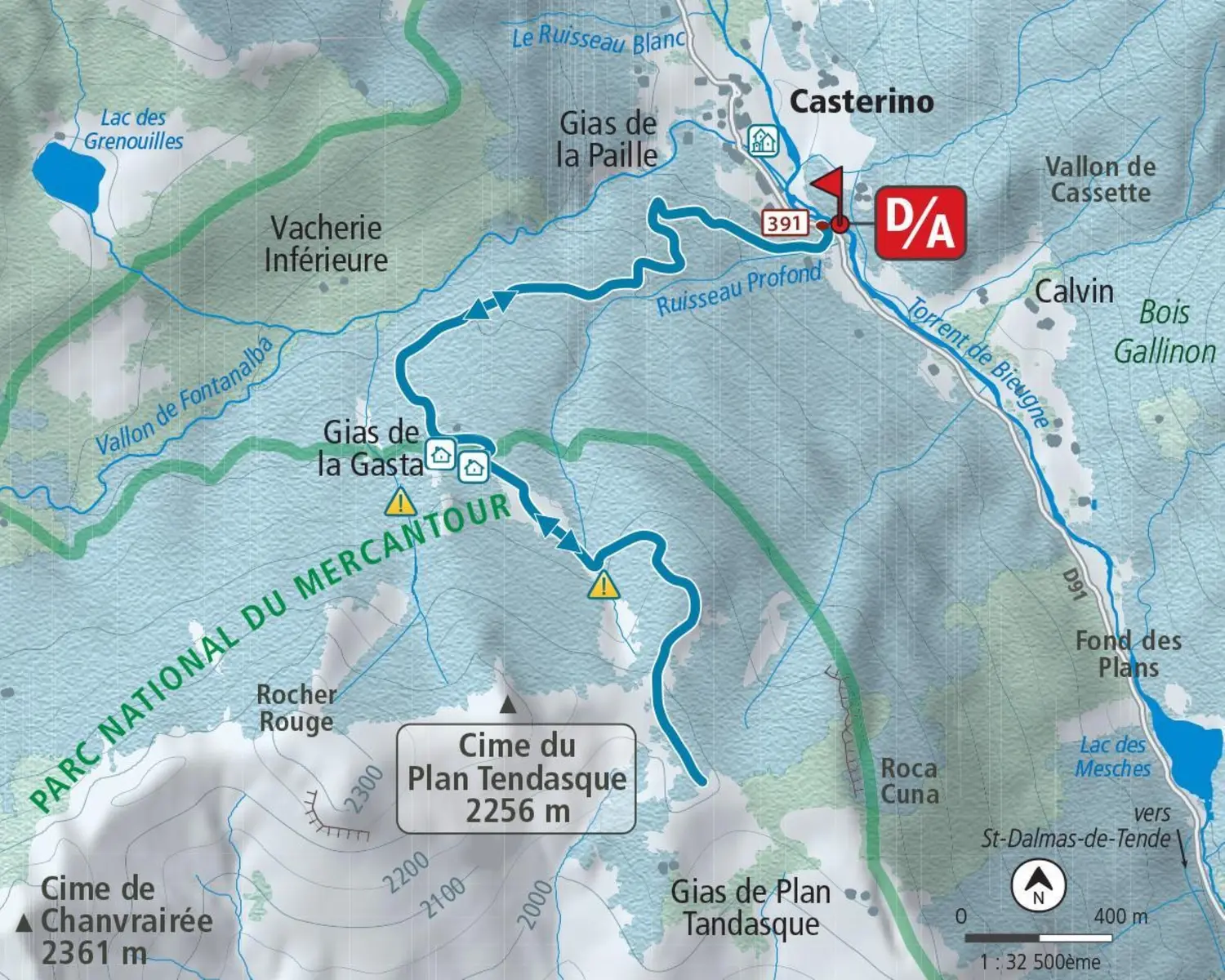
This undergrowth hike, only signposted for the first few kilometers, leads to a wide ridge between the peaks of Roca Cuna and Plan Tendasque. You arrive at a vast panorama: Castérino, la Minière, l'Agnelino and la Roche de l'Abisse.
- From the hamlet of Castérino (1,550 m - b.391), climb up the wide old military road on the orographic right bank of the Fontanalbe valley through a forest of spruce and fir.
- After two large hairpin bends, you come out onto a small plateau with widely-spaced larches, and continue westwards along the path that leads to the Fontanalbe refuge, rising gently to 1,800 m above sea level.
- Just before the end of the wood, leave a large avalanche corridor to the west and climb a steep slope to the left (south), always staying on the orographic right bank of the corridor.
- Pass ruins and turn left to reach the buildings of Gias de la Gasta (1,925 m) at the foot of a rocky spur: continue to climb to the left to reach a flat, which you cross in a south-easterly direction until you reach a well-marked valley.
- Then climb up a wooded ridge to the right (south) to reach the wide ridge (2,010 m) between the Plan Tendasque and Roca Cuna peaks. Continue easily to the left along the ridge (southeast) until you emerge from the forest and reach a characteristic knoll (2,100 m) overlooking Plan Tendasque.
- Return by the same route
Services
Parking nearby
Accessibility
Not accessible in a wheelchair
Rates
Free access.
—
Openings
From 1 January 2026 until 30 April 2026 - Open everyday
Depending on snow conditions
From 1 December 2026 until 30 April 2027 - Open everyday
Depending on snow conditions
Location
Spoken languages
Spoken languages
Environment
Environment
- Riverside
- Close to GR footpath
- Mountain view
- Panoramic view
- Forest location
- Waterside
- Lake view
- Mountain location
- Isolated
- Sensitive Natural Area
Access
Access
- From Menton, follow the A8 east to Ventimiglia (Italy). Drive up the Roya valley on the main road, then on the RD 6204, passing Breil-sur-Roya, Fontan and St-Dalmas-de-Tende.
At the end of this last village, fork left (RD 91) to reach the hamlet of Casterino.