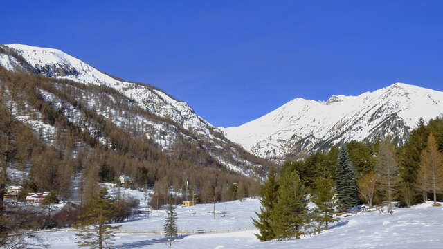
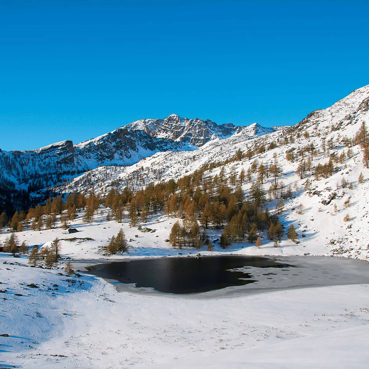
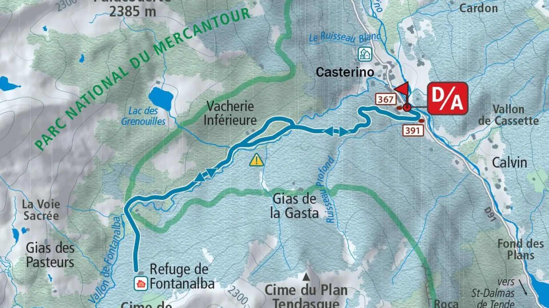
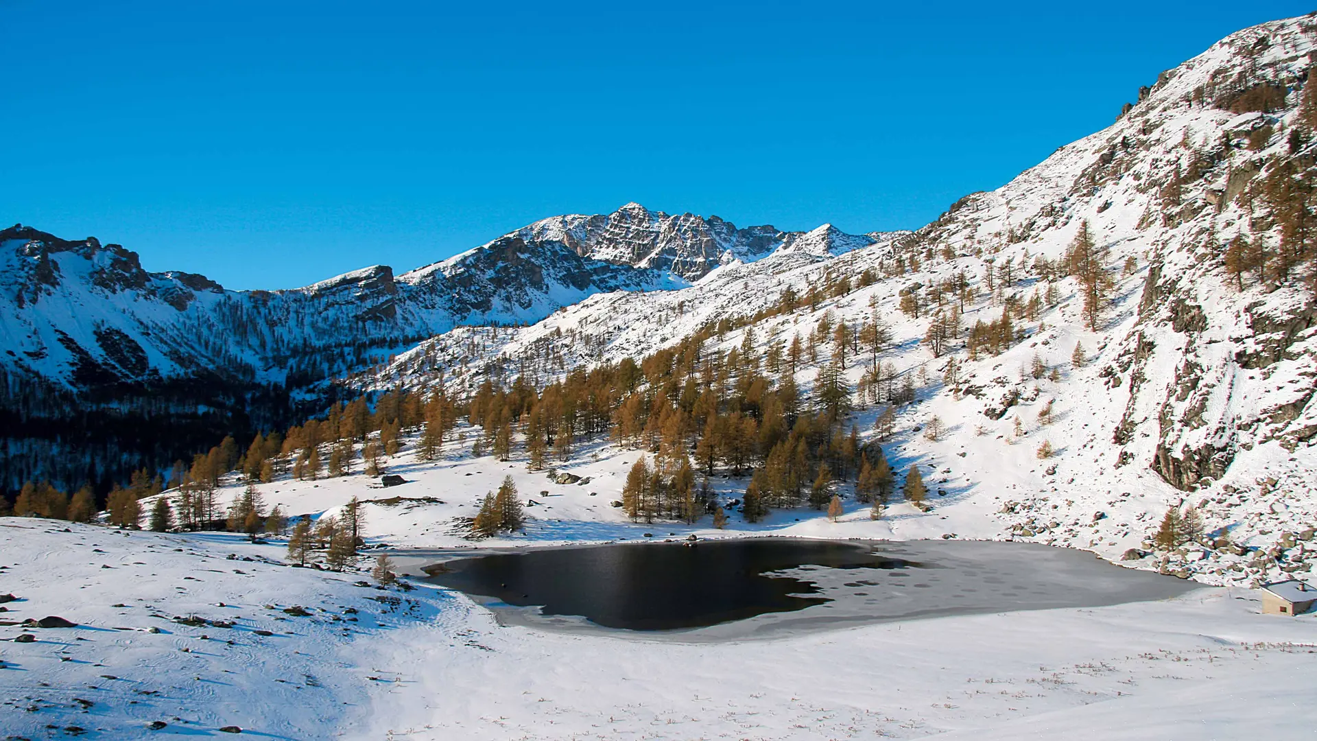
To the north-east of Mont Bégo, the high valley of Fontanalbe seduces with its orange schists and famous Bronze Age engravings. In winter, the engravings are under snow, but the site remains majestic and offers a beautiful forest walk.
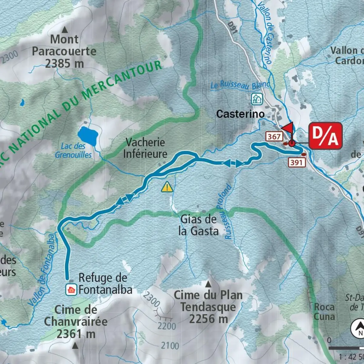
- From the hamlet of Castérino (1,550 m - b.391), follow the old military road, generally visible in the snow, which starts on the right bank of the Fontanalbe valley and rises easily through fir and spruce trees.
- After passing two large switchbacks, the track climbs up a ridge and opens up into a nice clearing; continue on it for a while before turning right (1,738 m) between scattered trees to find a clear path that crosses the slope and leads down to the right bank of the Fontanalbe valley.
- Climb the latter for a few hundred metres to cross the torrent on a wooden structure and reach the small plateau on the opposite bank. Walk past the barns to find the contour line and climb up this side of the slope.
- Cross a small talweg and, via a slightly uphill crossing in a sparse mélézin, join the track after a small hump: turn left to cross the stream and find two buildings at the Parc du Mercantour gate (1,941 m - b.390).Turn right to reach a bare hillock and just after (1,963 m) an undulating slope which can be climbed (south) without difficulty to the Fontanalbe refuge (2,018 m - b.389).
- Climb back down to the bridge over the valley (b.390), cross the torrent and turn right to start the descent back to Castérino via the outward route.
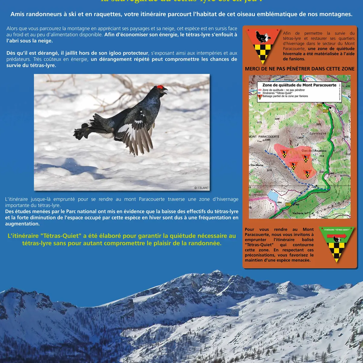
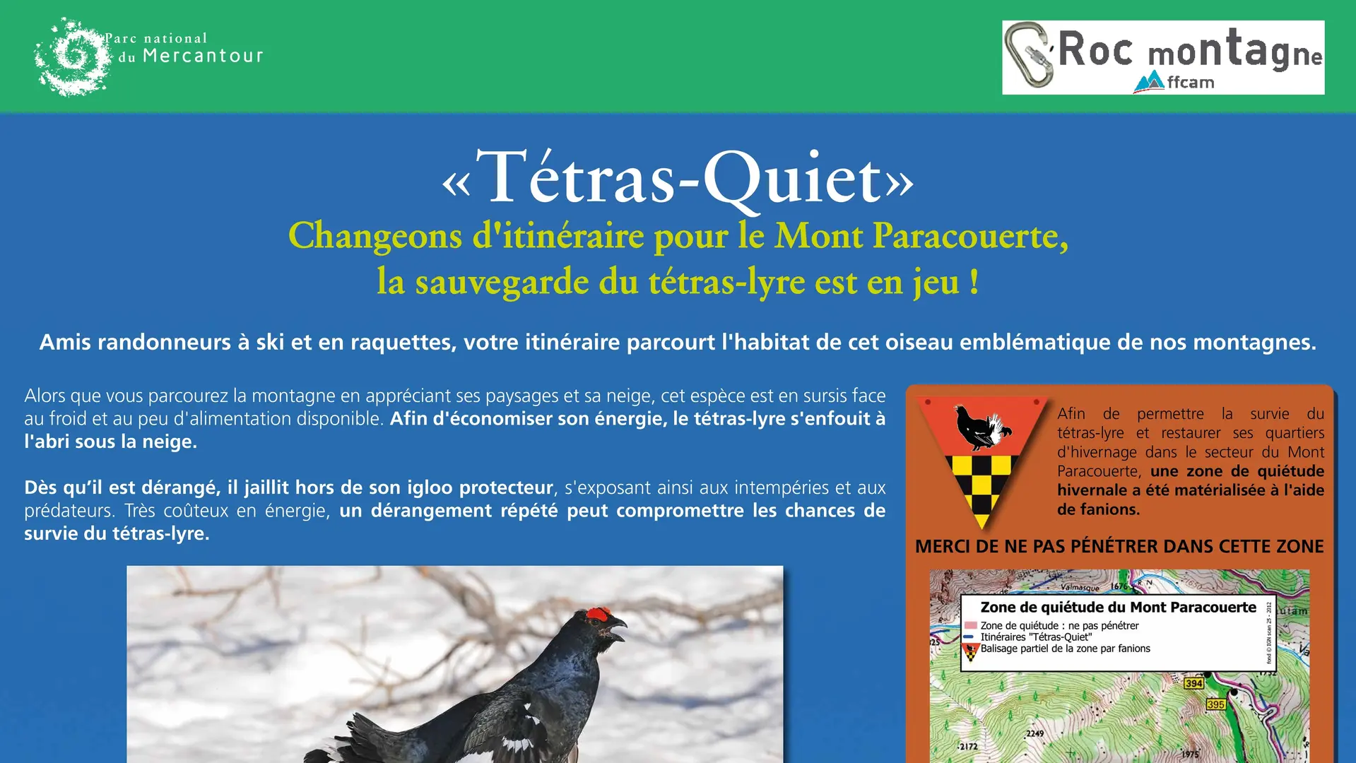
N.B.: On this route, the Mercantour National Park has decided to promote the peace and quiet of the black grouse during the winter months. Specific markings have been put in place to encourage you to avoid the quiet zones. Thank you for respecting them, and for contributing to the survival of this species during the winter.
Services
Parking nearby
Accessibility
Not accessible in a wheelchair
Rates
Free access.
—
Openings
From 1 January 2026 until 31 March 2026 - Open everyday
Depending on snow conditions
From 1 December 2026 until 31 March 2027 - Open everyday
Depending on snow conditions
Subject to favorable weather
Subject to snow conditions
Location
Spoken languages
Spoken languages
Environment
Environment
- Riverside
- Close to GR footpath
- Mountain view
- Panoramic view
- Forest location
- Waterside
- Lake view
- Mountain location
- Isolated
- Sensitive Natural Area
Access
Access
- From Menton, follow the A8 east to Ventimiglia (Italy). Drive up the Roya valley via the penetrante, then the RD 6204, passing Breil-sur-Roya, Fontan and St-Dalmas-de-Tende.
At the end of the latter village, fork left (RD 91) to reach the Mesches dam-lake.