
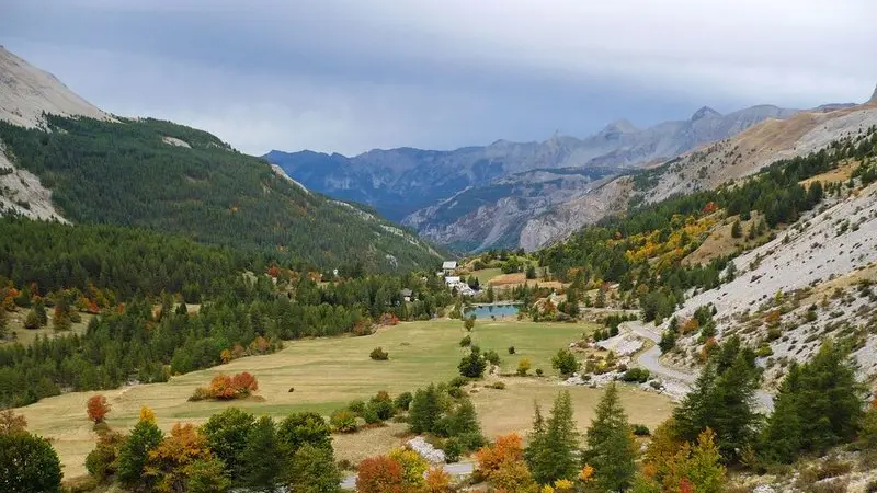
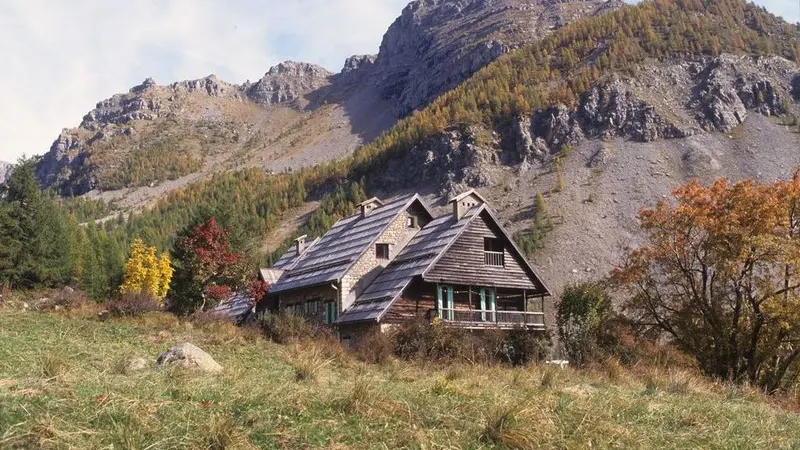
Enjoy a family walk, discovering the refuge of La Cantonnière, where the workers building La Route des Grandes Alpes used to stay.
From La Cantonnière refuge, head down the road for 50m until you reach marker 41. Follow the path which is bordered by fields, whose rich grass is still used for agriculture, until you reach the small artificial lake.A short return trip of a few minutes to the right will allow you to discover the source of the Var river.Continue on the left, following a path which heads upwards alongside the Sanguinière brook. After having crossed the latter via a footbridge, you will enter a pretty larch forest.At the crossroads, turn left where you will cross three small bridges and continue heading alongside the Sanguinière brook.At the intersection of the paths, turn right and head upwards until you reach a light clearing which is dotted with rocks. You will then need turn left to follow the hairpins of the path with yellow markers.At marker 282, continue on the left on a path which runs alongside a canal then cross a wide footbridge when you reach marker 281.Turn left onto the road and go back down to the refuge.
Difficulté = Very easy
Location
Contact Tour of the Estenc plateau
Access
Access
- Departure : La Cantonnière refuge.
Arrival : La Cantonnière refuge.
La Cantonnière refuge is located 800m after you leave the hamlet of Estenc, at the roadside on your left (6km prior to Col de la Cayolle).
The refuge can be accessed all year by car. In the winter, it represents the end of the D2202 as the snow is not cleared from the road any further than this point.
Parking : La Cantonnière refuge carpark.
