Description
This beautiful (and long) route, which connects the picturesque villages of Saorge and Breil, runs along the north-facing slope of the Roya River on the left bank, almost entirely through the forest: depending on the direction you take, you’ll pass through woods of various tree species, including chestnut and ash trees...
Saorge is a medieval village listed among the "Most Beautiful Villages of France," and it is entirely pedestrian-only.
If you arrive by car, you can park on the eastern side of the village: there are two parking lots below the Church of the Madonna del Poggio, on the RD 138.
By public transportation, you’ll arrive on the northwest side via the RD 38 from the village of Fontan, or at the shared train station in Fontan and Saorge (a 1/4-hour walk from the village) via the TER Nice-Breil-Tende (Train des Merveilles), or via the Italian train on the Ventimiglia-Cuneo line, or by bus—the Zest Bus No. 25 Menton-Tende, which drops you off at the village entrance, Place Honoré Steva.
From City Hall, continue straight ahead, passing the Caïros bookstore and tea room and the Chapel of the Red Penitents (which also serves as a post office and tourist information center) on your right, cross Place Georges Clémenceau—known as “Ciapagne” in the local Saorgian dialect—then turn right downhill past the Heinz bar to take Rue Virgile Barrel. Follow it, pass by the Vival grocery store, then head back up, passing the Val Roya cookie factory, to reach Rue Jean Revelli, which becomes Rue Louis Périssol, where you’ll find the restaurants Lou Pountin and La Petite Epicerie.
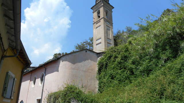
Be sure to take a moment to admire, on your left, the Saint-Claude Chapel of the Black Penitents—which serves as a library when open—and then the charming Medge washhouse with its warm ochre-colored walls.
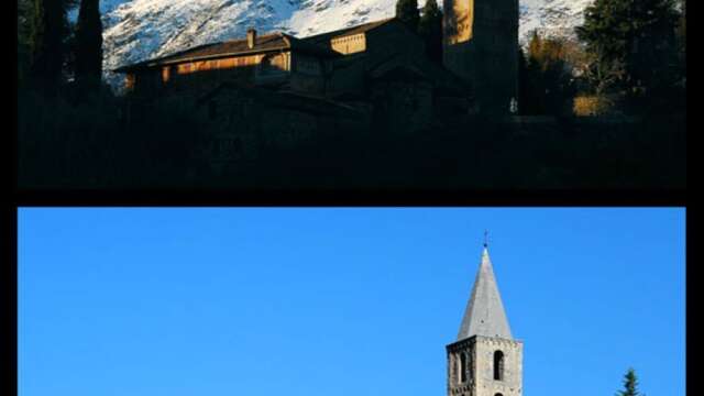
When you reach the end of the street (marker 20), leave the Monastère hill on your left and head downhill: on your left are the large buildings of the retreat center “Le Temps des cerises”; further down on the right, around the bend, is the Madone del Poggio, one of the very rare masterpieces of Romanesque art in the Alpes-Maritimes.
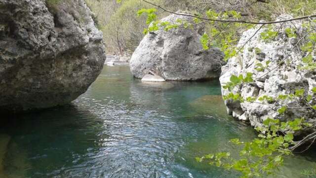
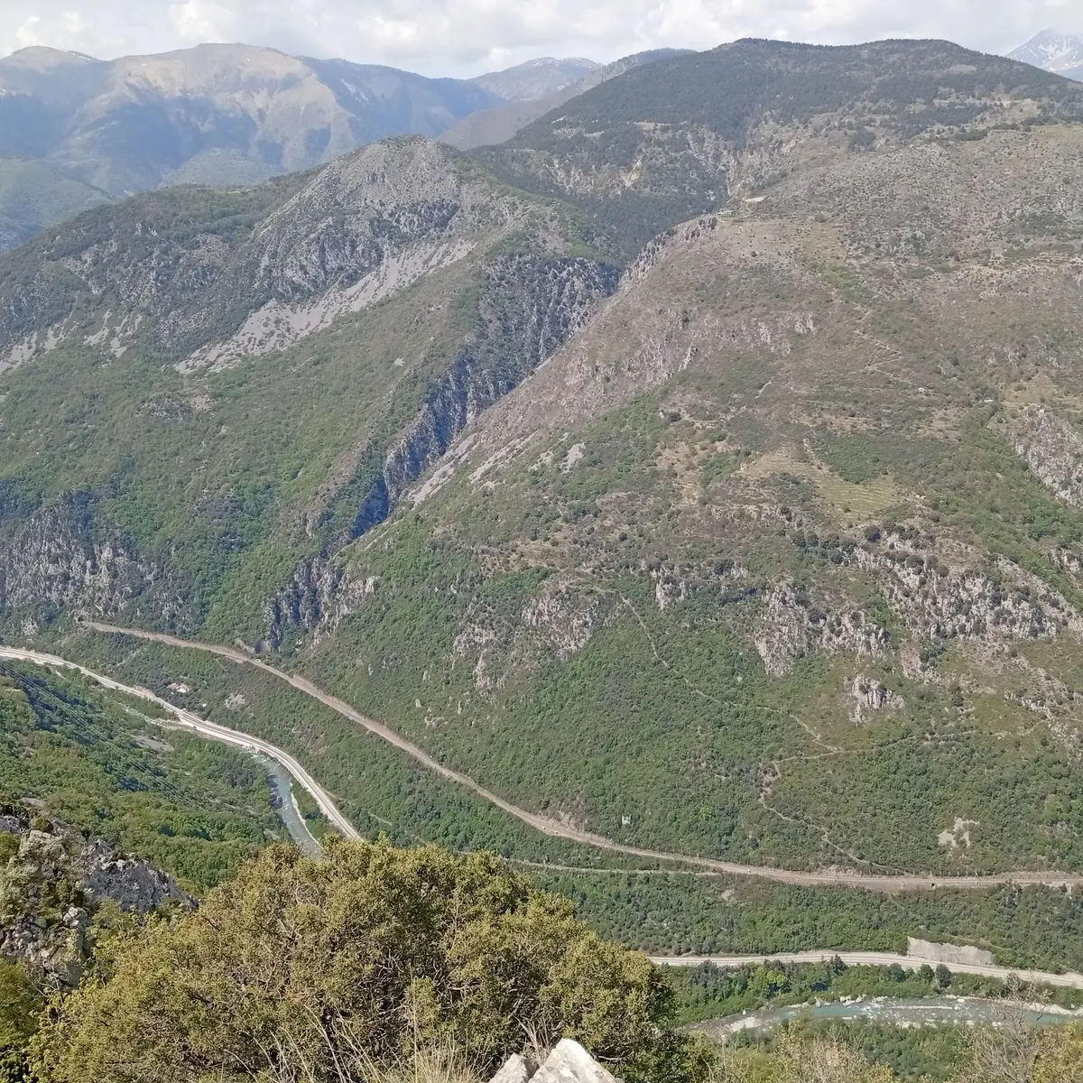
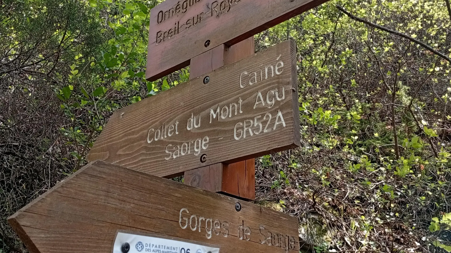
Continue downhill on the RD138 until you reach the large bend where a track branches off to the left. A lovely trail descends just below this track, marker 161, toward “Pont de Baoussoun.” This trail crosses the Bendola torrent, Europe’s longest canyon.
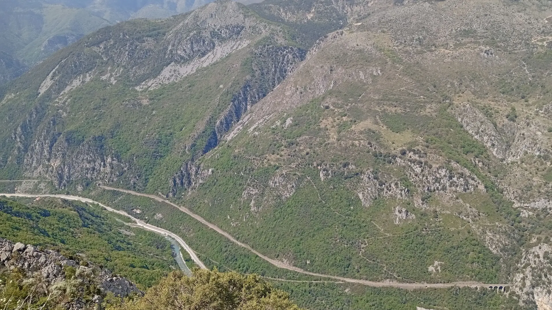
The route, marked with signs 160, 159, and 158, winds upward through the beautiful chestnut forest of Mont Agu, offering you magnificent views of the south-facing slope of La Bendola—inhabited and carved by terraced fields—with the Sainte-Croix Chapel, the hamlet of Castou below, and, towering over it all, the rounded summit of the Anan pastures.
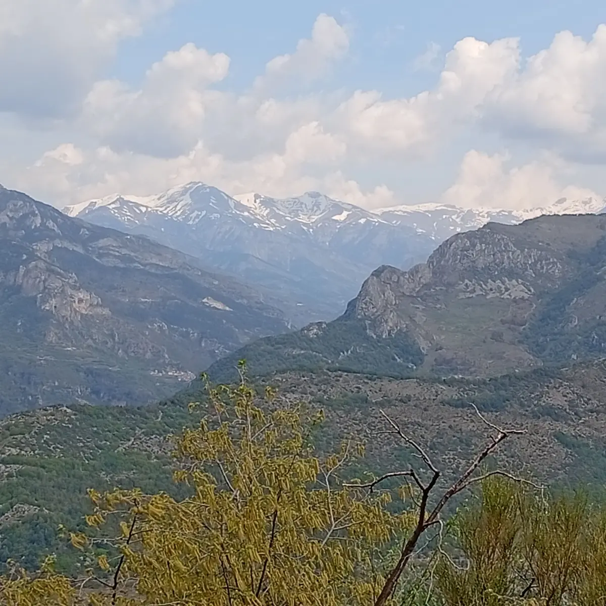
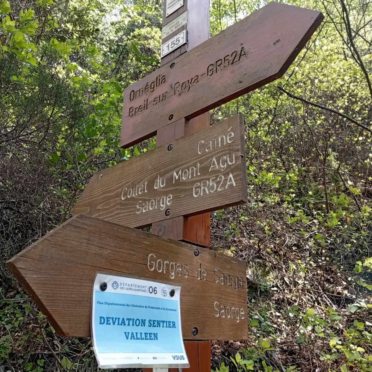
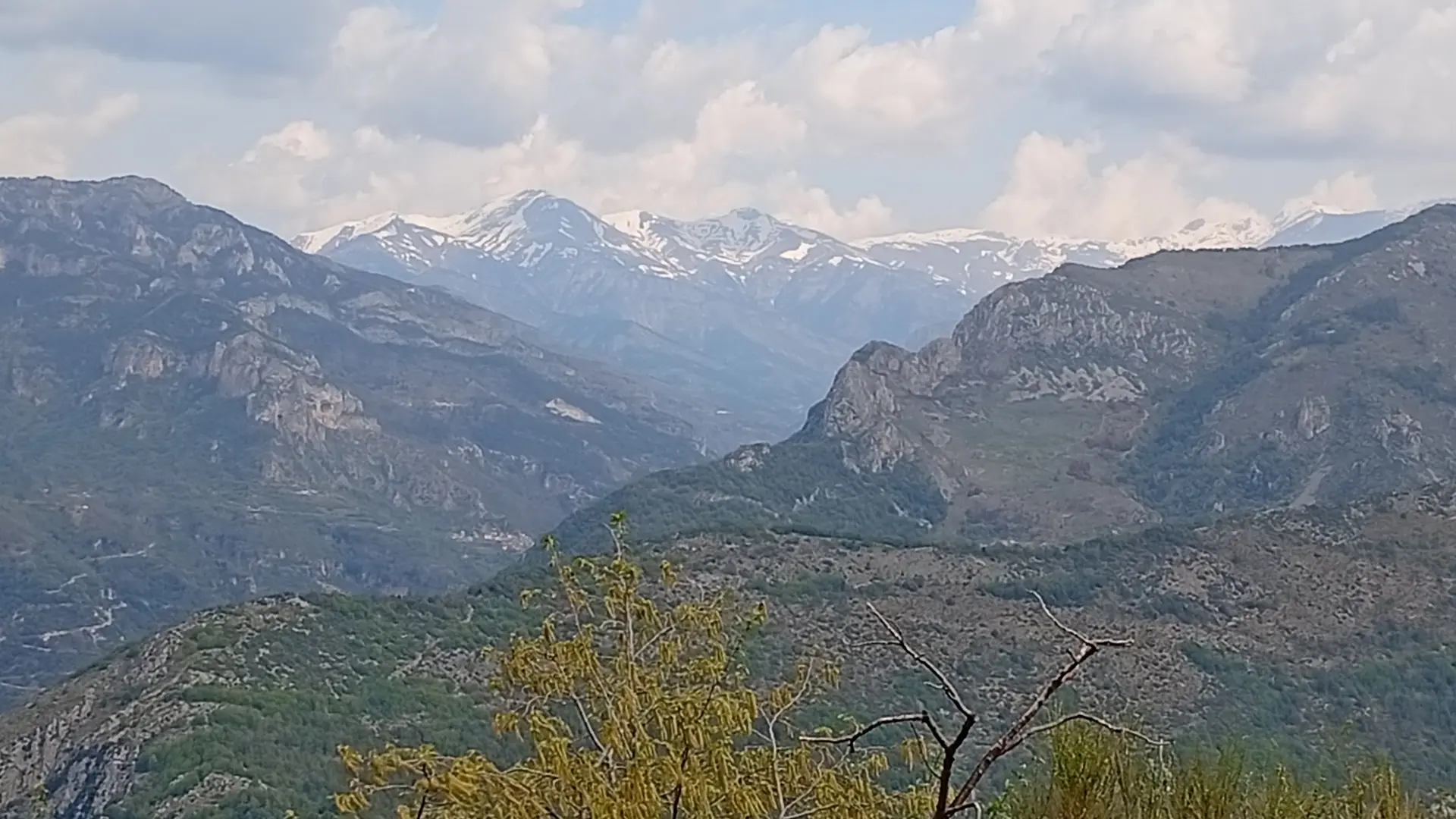
This brings you to the Collet du Mont Agu: A small trail on the right leads up to the ridge, where you can take a picnic break and snap some beautiful photos of the Haute-Roya mountains (Mont Bertrand), still snow-capped in the spring, to the north, and the south-facing slopes of the Roya’s right bank, toward the Paspus Chapel, Laguna, and Malmort Castle.
Then you’ll begin a long descent, with occasional climbs through successive valleys, until you reach markers 155 and 154.
At marker 153, do not descend toward Orneglia, but stay on the GR, which climbs again, descends further on, and then climbs once more to cross the Zouïané valley (marker 108).
At marker 10, stay on the GR; do not descend to the right via the Pinède trail, as it is extremely steep.
Enjoy the splendid views of the village of Breil, its immense church, and its small lake surrounded by mountains—markers 6 and 4.
On your left, a trail leads up to the medieval watchtower of La Cruella: a few brave souls might take the detour to this breathtaking view after following the twists and turns of the GR...
You’ll certainly want to treat yourself to a well-deserved refreshment upon your arrival in Breil!
You can catch the No. 25 bus at Place Biancheri, or at the train station, which is less than a 10-minute walk away.
This route should be avoided in the middle of winter: facing north, some very steep sections become very wet and therefore slippery.
During the hottest months, you’ll be walking mostly under the canopy of trees, but since the elevation is low, the route remains hot even in the middle of summer.